Medicine Lodge Lookout
CAN 5, AB 5
Lookout Details
| Registry Numbers | CAN 5, AB 5 (view other lookouts in Canada, Alberta) |
| Date Registered | July 15, 1997 |
| Nominated by | O'Brien Tarnasky, District Ranger |
| Location | Cypress Hills Interprovincial Park, Alberta |
| Coordinates |
N 49° 39.334' W 110° 19.667' (view using Google Maps) N 49° 39' 20" W 110° 19' 40" N 49.655560° W 110.327780° |
| Elevation | 4,159 ft (1,268 m) |
| Administered by | Dept. of Environmental Protection, Natural Resources Service-Parks |
| Cooperators | Cypress/Milk River District |
Description
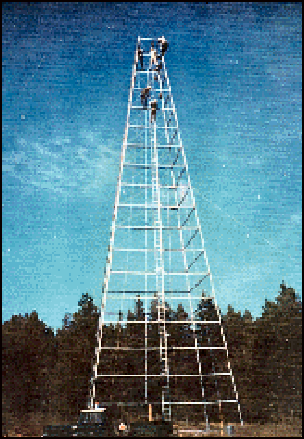
The Cypress Hills are the highest elevations between the Rocky Mountains and Labrador. Located on the Alberta/Saskatchewan border, they are rich in history. The Medicine Lodge Lookout was originally erected in 1967 as a 100, steel tower with a round crows nest cab. Dismantled in 1993, it was reestablished as a 20’ tower in memory of Forest Officer Thomas N. Trott.
Map
Change Basemap