Joe B. Shirley Fire Tower
US 680, AL 3
Lookout Details
| Registry Numbers | US 680, AL 3 (view other lookouts in United States, Alabama) |
| Date Registered | October 18, 2006 |
| Nominated by | Jane Barr, President, Monte Sano Historical Association |
| Location |
Monte Sano State Park Madison County, Alabama |
| Coordinates |
N 34° 43.883' W 086° 30.270' (view using Google Maps) N 34° 43' 53" W 086° 30' 16" N 34.731380° W 086.504500° |
| Elevation | 1,598 ft (487 m) |
| Built | 1968 |
| Administered by | State of Alabama, Monte Sano State Park |
| Cooperators | Monte Sano Historical Association |
Description
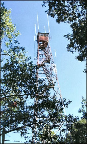
The 100' Joe B. Shirley Fire Tower is an Aermotor model with 7'x7' metal cab constructed in 1968 by the Alabama Forestry Commission. It replaced an earlier wooden tower dating to the 1940s. Located in Monte Sano State Park, the lookout was used in the 1950s by NASA to track and record telemetry from Sputnik 1 and Explorer 1 satellites.
Map
Change Basemap
Photos
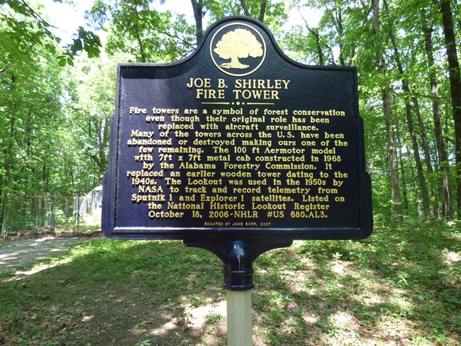
Historical Marker (Andrew Zerbe photo)