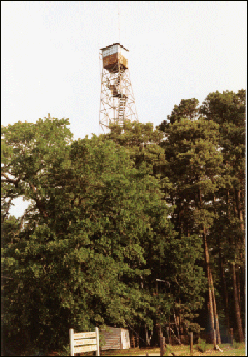
Poison Springs Fire Tower
US 176, AR 1
Lookout Details
| Registry Numbers | US 176, AR 1 (view other lookouts in United States, Arkansas) |
| Date Registered | July 16, 1996 |
| Nominated by | Arkansas Forestry Commission |
| Location |
Poison Springs State Forest Ouachita County, Arkansas |
| Coordinates |
N 33° 39.035' W 093° 01.495' (view using Google Maps) N 33° 39' 02" W 093° 01' 30" N 33.650580° W 093.024911° |
| Elevation | 381 ft (116 m) |
| Administered by | Arkansas Forestry Commission |
| Cooperators | Arkansas Forestry Commission |
Description
Constructed by the CCC in 1938, the Poison Springs Fire Tower served Poison Springs State Forest and surrounding counties until 1985. The 100, steel Aermotor tower with 7’ x 7’ cab is now used by the Arkansas Forestry Commission as a radio relay site.
Map
Change Basemap