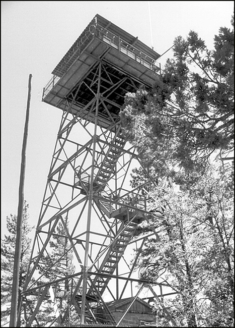
Juniper Ridge Lookout
US 420, AZ 27
Lookout Details
| Registry Numbers | US 420, AZ 27 (view other lookouts in United States, Arizona) |
| Date Registered | March 4, 2002 |
| Nominated by | Dave Lorenz, Director, AZ/NM FFLA |
| Location |
Apache-Sitgreaves National Forest Navajo County, Arizona |
| Coordinates |
N 34° 16.169' W 110° 11.457' (view using Google Maps) N 34° 16' 10" W 110° 11' 27" N 34.269480° W 110.190950° |
| Elevation | 6,985 ft (2,129 m) |
| Administered by | U.S. Forest Service |
| Cooperators | Lakeside Ranger District |
Description
Overlooking the adjacent Fort Apache Indian Reservation as well as the Apache-Sitgreaves National Forest, Juniper Ridge has a 54' metal tower with a live-in 14’x14' metal CL 100 cab with catwalk built in 1959. With an elevation of 6985' it is in active service.
Map
Change Basemap