Deadwood Peak Lookout
Lookout Details
| Registry Numbers | US 1396, CA 219 (view other lookouts in United States, California) |
| Date Registered | December 23, 2019 |
| Nominated by | Brad Eells |
| Location |
Sierra National Forest Madera County, California |
| Coordinates |
N 37° 18.813' W 119° 41.156' (view using Google Maps) N 37° 18' 49" W 119° 41' 09" N 37.313553° W 119.685935° |
| Elevation | 4,547 ft (1,386 m) |
| Built | 1934 - Addition 1952 |
| Administered by | California Department of Forestry and Fire Protection |
| Cooperators | US Forest Service - Sierra National Forest |
Description
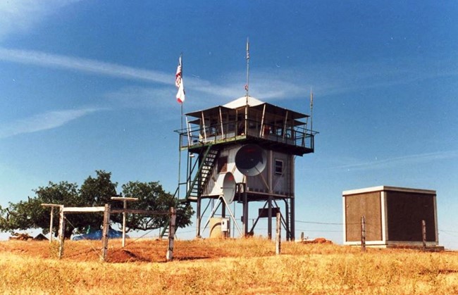
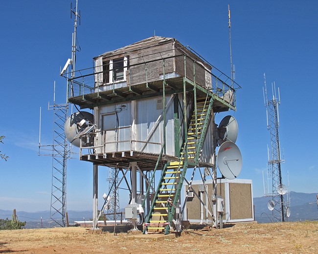
The tower and cab were constructed by the Civilian Conservation Corps for the Sierra National Forest. CDF took over the site in 1950 and added the "Cook's Quarters" (utility room below the cab) in 1952. Building materials complimentary to the cab were used for this addition. Thus, the structure is still highly reflective of its CCC roots. Minor alterations include: aluminum siding, composition roofing, and guard rail additions; shutter replacement; and various interior revisions. A steel fire escape ladder is on the north side of the tower. The utility room houses a water pump system, refrigerator, bedding and storage cabinets. A 300 gallon concrete water storage tank is at the base of the tower. CDF has only two L-401 towers.
Deadwood Peak is situated upon the apex of Potter Ridge. The five mile long, southeasterly tending summit is located to the southwest of Oakhurst. The area around the lookout station is predominate in oak woodland, with brush and pine intermix on the lower mountain slopes. There are microwave dishes on the lookout and radio vaults and towers at this site. The area is not readily accessible to the public, being some 4.5 miles from paved road, behind locked gates.
Map
Photos
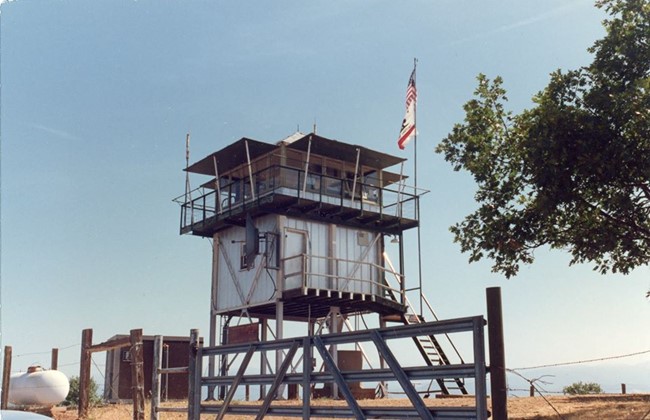
Photo courtesy of Steve Maurer
2010
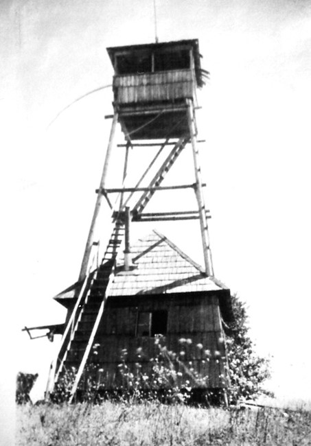
1912