Mount Danaher Lookout
US 399, CA 50
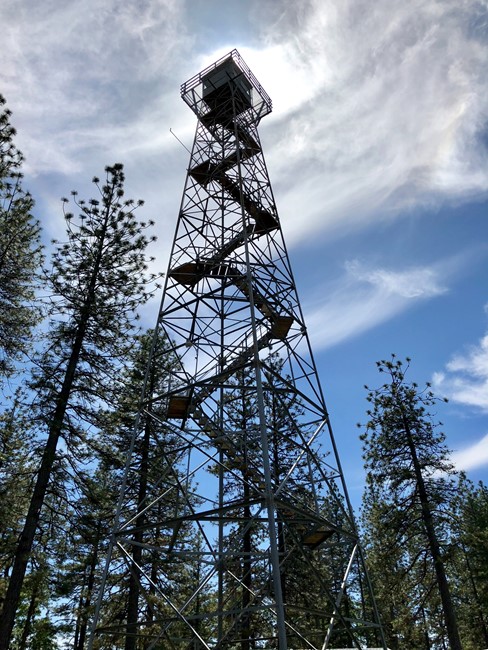
May 2018 photo
Lookout Details
| Registry Numbers | US 399, CA 50 (view other lookouts in United States, California) |
| Date Registered | January 12, 2002 |
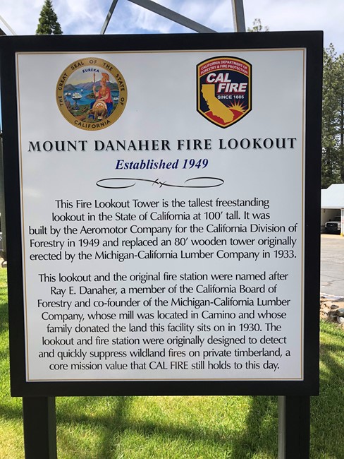
| Location | El Dorado County, California |
| Coordinates |
N 38° 44.664' W 120° 40.014' (view using Google Maps) N 38° 44' 40" W 120° 40' 01" N 38.744400° W 120.666900° |
| Elevation | 3,362 ft (1,025 m) |
| Built | 1949 |
| Administered by | California Department of Forestry |
| Cooperators | California Department of Forestry |
Description
There are six historic buildings at California Department of Forestry's Amador-El Dorado Ranger Unit Headquarters. One of them is Mount Danaher Lookout, a 100' steel tower with metal cab. Built in 1949 on land that was donated in 1930, it is the tallest in the state system. Located on a secure facility, it is maintained for emergency use and as a historic site.
Map
Change Basemap
Photos
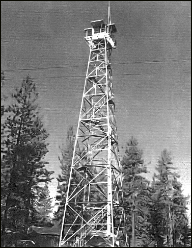
Lookout history display
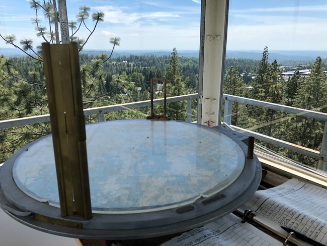
Fire finder in May 2018
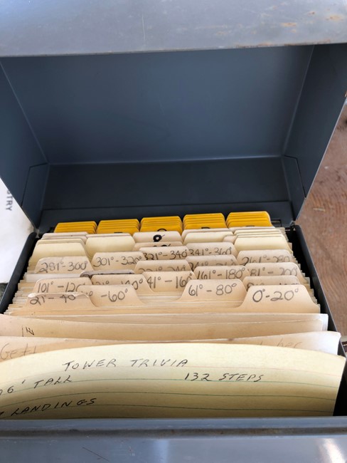
Fire finder location cards