Photo courtesy of Mike Guerin
Lookout Details
| Registry Numbers | US 1305, CA 128 (view other lookouts in United States, California) |
| Date Registered | August 1, 2019 |
| Nominated by | Mike Guerin |
| Location |
Mount Diablo State Park Contra Costa County, California |
| Coordinates |
N 37° 52.906' W 121° 54.856' (view using Google Maps) N 37° 52' 54" W 121° 54' 51" N 37.881770° W 121.914265° |
| Elevation | 3,849 ft (1,173 m) |
| Built | 1938 |
| Administered by | California Department of Parks and Recreation |
Description
Despite this site having been a tower for many years, there has been some confusion as to its use as a fire lookout on a regular basis. Research has verified its use for this purpose.
At 3849 Feet, Mount Diablo in California’s East Bay region has a commanding view that stretches to the Coast Range, the Cascades and the Sierra Nevadas. The site’s suitability as a fire detection point for the local area was voiced by locals as early as 1923, as Ron Kemnow records in his compilation of newspaper reports on the subject.
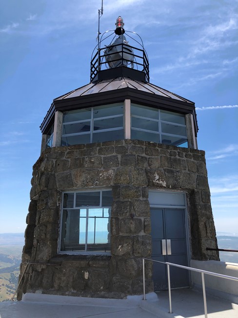
The area around the summit became a park in 1921 and in 1931 became Mount Diablo State Park in 1931, one of the state’s first. The CCC, which had a camp on the south side of the mountain, began work on the summit building in 1938. At the outset the building was designed to house not only a viewing deck but also a fire lookout, museum exhibits and atop it all - a rotating aircraft beacon, a key means of navigation at the time. The building was constructed of sandstone quarried on park property. Standard Oil donated money for the mortar, steel and other materials needed to complete the structure. The structure leaked badly, and remedial construction occurred several times to correct the problem.
Despite some written references to its use as a detection point, several Rangers in the park and books about the area do not mention this usage. Through the help of the Mt. Diablo Interpretive Association contact was made with a retired State Park Ranger who verified that it was indeed a lookout for a time (prior to his arrival in 1975.) The uppermost floor was used by lookouts - often a married couple. He recalled a wooden structure in the center of the room, likely an alidade table. The lookouts lived in the basement of the building. The lookout area is now occupied by radio repeater equipment, and is not accessible. (Correspondence with Burt Bogardus.)
Also of note is the fact that this spot is the baseline meridian for land surveys in Northern California.
Map
Photos
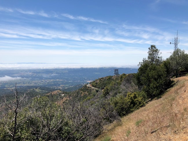
Photo courtesy of Mike Guerin
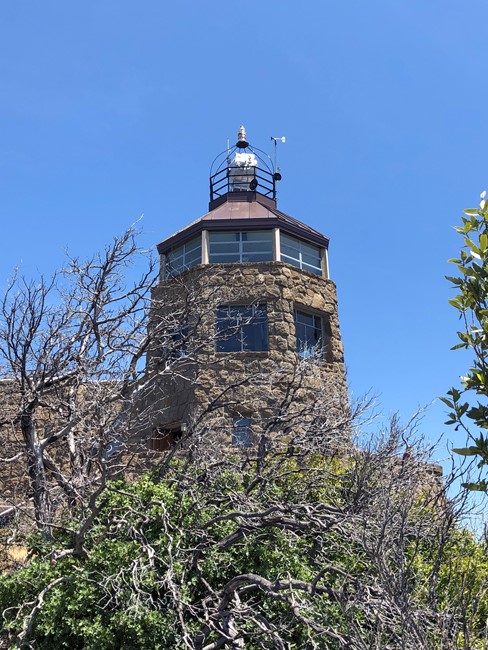
Photo courtesy of Mike Guerin
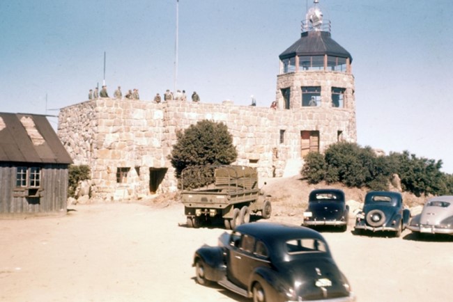
Photo courtesy of savemountdiablo.org
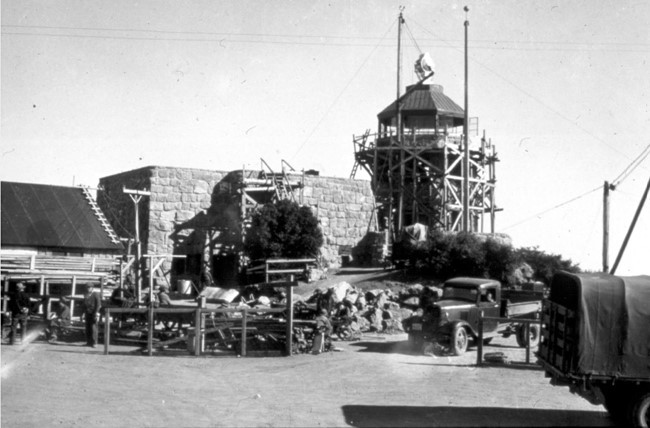
Photo courtesy of savemountdiablo.org