Shadequarter Lookout - 2008
Lookout Details
| Registry Numbers | US 1370, CA 193 (view other lookouts in United States, California) |
| Date Registered | October 30, 2019 |
| Nominated by | Brad Eells |
| Location | Tulare County, California |
| Coordinates |
N 36° 34.038' W 118° 57.402' (view using Google Maps) N 36° 34' 02" W 118° 57' 24" N 36.567295° W 118.956695° |
| Elevation | 4,381 ft (1,335 m) |
| Built | 1964 |
| Administered by | California Department of Forestry and Fire Protection - Tulare Unit (Cal Fire TUU) |
Description
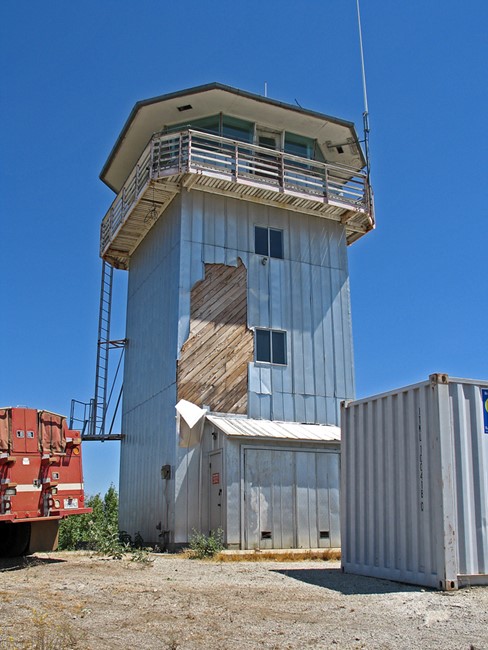
The 809R building design, constructed in 1964, is believed to be exclusive to the California Department of Forestry. This is a later vintage tower than most 809R lookouts and, as such, conforms to certain design revisions. These revisions include tilted, stationary plate glass, steel columns (mullions) in cab for roof support, and aluminum siding (although in this case, it is not green colored). The building is an excellent 809R example, having undergone few changes. Bathroom facilities are on the second floor, the third floor serves as a bedroom. A propane range and standard built-in cabinets are in the cab.
Two above ground, concrete tanks (on the south side of the tower) provide about 3,000 gallons of water storage. A down-spout (from cab rain gutters) dumps into these tanks.
This station is situated about midpoint in a several mile long, crescent shaped ridge. Shadequarter Mountain's summit is primarily covered in brush and annual grasses, with a scattering of oaks and pine. The site is not accessible to the general public, being about 5 miles from paved road, behind locked gates. There is a Remote Automatic Weather Station (RAWS) west of the lookout, and a radio repeater is housed in the tower. (MVT 10/91)
The Buck Rock Foundation conducted an assessment visit in 2018 and has an interest in bringing the tower back for fire detection service:
"Shadequarter Lookout was built by the state of California in 1964 and was an important fire detection tool for much of the Kaweah River watershed until poor air quality and budget cuts caused the tower to be shuttered in the late 1980's. The lookout consists of a three-story tower erected on a substantial concrete foundation, which is cast in place on existing granite bedrock. The 30 foot tall steel tower is separated into three floors and is topped by a fourth floor working lookout cab. Most of the interior has been removed including all fire related equipment (the firefinder and firefinder base have been saved and are available if the lookout is to be reopened}. After a thorough inspection, we found that overall the lookout is in surprisingly good condition, with the exception of damage to the aluminum roofing and siding as well as several broken windows. It would require a lot of work, however, to bring it back into service.
The BRF is interested in the future of Shadequarter because if staffed it would fill in the gaps of territory not currently seen by Buck Rock, Delilah and Park Ridge lookouts, thereby complimenting our current fire detection program goals. At this time, it is CAL FIRE's priority to preserve the structure while it considers options for its future use. Shadequarter Lookout is located on private land in the Eshom Valley area of Tulare County." (Buck Rock Foundation - 2018 Annual Report)
Map
Photos
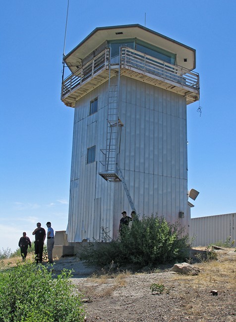
Photo courtesy of www.peakbagging.com
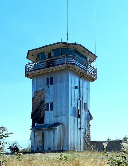
2011
Buck Rock Foundation group visit - 2018