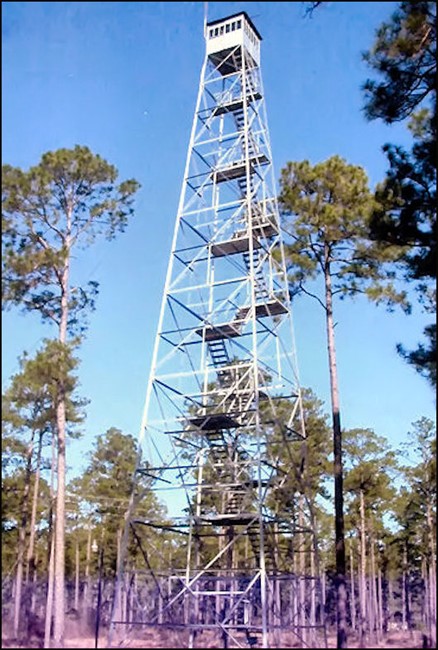
Early County Fire Tower
US 661, GA 5
Lookout Details
| Registry Numbers | US 661, GA 5 (view other lookouts in United States, Georgia) |
| Date Registered | March 15, 2006 |
| Location |
Town of Blakely Early County, Georgia |
| Coordinates |
N 31° 21.948' W 084° 56.492' (view using Google Maps) N 31° 21' 57" W 084° 56' 30" N 31.365800° W 084.941530° |
| Elevation | 283 ft (86 m) |
| Built | 1952 |
| Administered by | Georgia Forestry Commission |
| Cooperators | Georgia Forestry Commission |
Description
The 100’ Aermotor Early County Fire Tower with a 7’x7’ metal cab was constructed by the Georgia Forestry Commission in 1952 and staffed until 1987. It is now a community landmark and used as a radio facility.
Map
Change Basemap