Hell's Half Acre Lookout
US 790, ID 72
Lookout Details
| Registry Numbers | US 790, ID 72 (view other lookouts in United States, Idaho) |
| Date Registered | April 24, 2009 |
| Nominated by | Gary Weber |
| Location |
Bitterroot National Forest Idaho County, Idaho |
| Coordinates |
N 45° 38.750' W 114° 37.700' (view using Google Maps) N 45° 38' 45" W 114° 37' 42" N 45.645830° W 114.628330° |
| Elevation | 8,116 ft (2,474 m) |
| Built | 1960 |
| Administered by | U.S. Forest Service |
| Cooperators | West Fork Ranger District |
Description
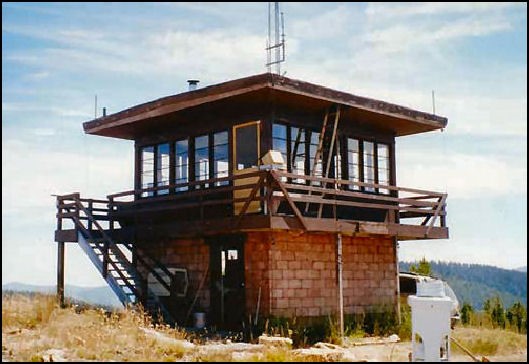
In 1930 Hell’s Half Acre Lookout on the Bitterroot National Forest was a platform on a 40’ tree top. In 1940 it was replaced by an L-4 cab on a 10’ tower, which in turn was replaced 20 years later by this R-6 flattop catwalk on a 10’ concrete base. From its spot four air miles south of the Montana Road in the Magruder Corridor, Hell's Half Acre Lookout overlooks the upper reaches of the Selway River in the adjacent Frank Church River of No Return Wilderness. It is regularly staffed during the fire season.
Map
Change Basemap
Photos
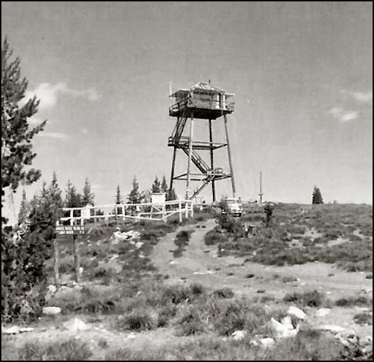
Photo courtesy Robert Evans, lookout observer 1955-56