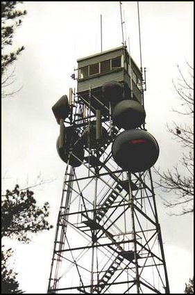
Chelmsford Fire Tower
US 732, MA 43
Lookout Details
| Registry Numbers | US 732, MA 43 (view other lookouts in United States, Massachusetts) |
| Date Registered | May 14, 2008 |
| Nominated by | Henry Isenberg |
| Location |
Robbins Hill Middlesex County, Massachusetts |
| Coordinates |
N 42° 35.100' W 071° 21.950' (view using Google Maps) N 42° 35' 06" W 071° 21' 57" N 42.585000° W 071.365830° |
| Elevation | 350 ft (107 m) |
| Built | 1939 |
| Administered by | Mass. Bureau of Forest Fire Control |
| Cooperators | Mass. Bureau of Forest Fire Control, District 6 |
Description
The 68’ Chelmsford Fire Tower with a 10’x10’ wooden cab was constructed by Mass. BFC in 1938. It is the fourth tower to be constructed on the site, including one that was destroyed by the hurricane of 1938.
Map
Change Basemap