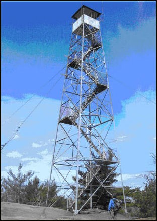
Mount Pisgah Fire Tower
US 736, ME 11

Lookout Details
| Registry Numbers | US 736, ME 11 (view other lookouts in United States, Maine) |
| Date Registered | June 10, 2008 |
| Nominated by | Bill Cobb |
| Location |
Town of Winthrop Kennebec County, Maine |
| Coordinates |
N 44° 18.365' W 070° 01.435' (view using Google Maps) N 44° 18' 22" W 070° 01' 26" N 44.306080° W 070.023920° |
| Elevation | 810 ft (247 m) |
| Built | 1949 |
| Administered by | Town of Winthrop, Maine |
| Cooperators | Town of Winthrop and Kennebec Land Trust |
Description
The Maine Forest Service constructed the Mount Pisgah Fire Tower in 1949. It is a 60’ Aermotor tower with a 7’x7’ cab. It is now owned and maintained by the Town of Winthrop and the Kennebec Land Trust and open to the public.
Map
Change Basemap