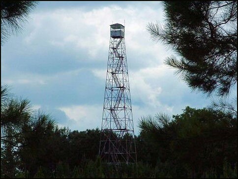
University Lookout Tower
US 525, MS 5

Lookout Details
| Registry Numbers | US 525, MS 5 (view other lookouts in United States, Mississippi) |
| Date Registered | July 24, 2003 |
| Nominated by | Judith Henry, District Ranger, De Soto RD |
| Location |
De Soto National Forest Stone County, Mississippi |
| Coordinates |
N 30° 43.977' W 088° 54.735' (view using Google Maps) N 30° 43' 59" W 088° 54' 44" N 30.732950° W 088.912250° |
| Elevation | 221 ft (67 m) |
| Administered by | U.S. Forest Service |
| Cooperators | De Soto Ranger District |
Description
Once the U.S. Navy owned 23,000 acres of land in southern Mississippi to provide virgin longleaf timber for ships masts. After wooden sailing ships were phased out this land was transferred to the State of Mississippi a 100 years ago as an endowment for the University of Mississippi. It was managed as University Forest Lands until 2000 when Congress purchased the tract for addition to the DeSoto National Forest. With this tract came the University Fire Tower, a 100’ International Derrick Co. steel tower with 7’x7’ metal cab. It is no longer in service but is maintained by the U.S. Forest Service for emergencies.
Map
Change Basemap