Lost Horse Lookout
US 1510, MT 88
Lookout Details
| Registry Numbers | US 1510, MT 88 (view other lookouts in United States, Montana) |
| Date Registered | January 9, 2021 |
| Nominated by | Kyle Stetler |
| Location |
Kootenai NF Lincoln County, Montana |
| Coordinates |
N 48° 47.545' W 115° 34.015' (view using Google Maps) N 48° 47' 33" W 115° 34' 01" N 48.792410° W 115.566914° |
| Elevation | 6,523 ft (1,988 m) |
| Administered by | US Forest Service |
Description
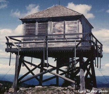
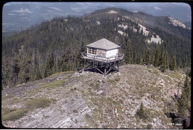
First used in 1921 as a camp lookout, the present 10' pole tower with L-4 cab was built in 1934, but has remained unused for many years. It was threatened by a forest fire in 1994.
Map
Change Basemap
Photos