Capilla Peak Lookout
US 695, NM 26
Lookout Details
| Registry Numbers | US 695, NM 26 (view other lookouts in United States, New Mexico) |
| Date Registered | June 17, 2007 |
| Nominated by | Dave Lorenz |
| Location |
Cibola National Forest Torrance County, New Mexico |
| Coordinates |
N 34° 42.084' W 106° 24.060' (view using Google Maps) N 34° 42' 05" W 106° 24' 04" N 34.701400° W 106.401000° |
| Elevation | 9,368 ft (2,855 m) |
| Built | 1963 |
| Administered by | U.S. Forest Service |
| Cooperators | Mountainair Ranger District |
Description
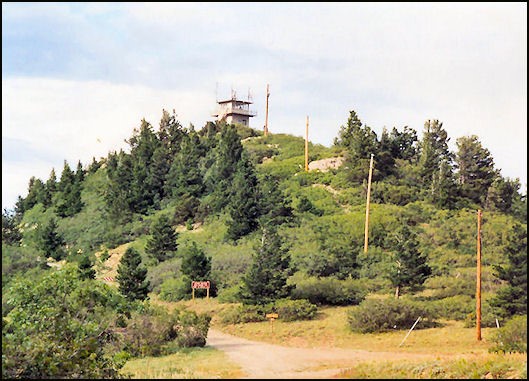
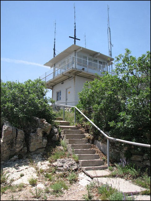
The present Capilla Lookout was erected in 1963. It is a CL-100 with a concrete block base. Historical information: Capilla Peak became an official lookout site in 1922 when a small cabin (L-4 style) was erected on the peak for the detection of forest fires. The first fire spotters accessed the peak on horse-back. A trail was completed in 1921 to the proposed lookout site from the Tajique Ranger Station. Cement, sand, lumber and windows were transported to the lookout site by pack mules. Two of the first lookouts assigned to the peak were C.A. Finley and Juan Chavez.
Map
Change Basemap
Photos