Gomer Hill Fire Tower
US 1697, NY 49
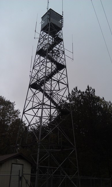
2012 photo
Lookout Details
| Registry Numbers | US 1697, NY 49 (view other lookouts in United States, New York) |
| Date Registered | December 23, 2022 |
| Nominated by | Laurie Rankin |
| Location |
State Forest Preserve Lewis County, New York |
| Coordinates |
N 43° 38.828' W 075° 28.916' (view using Google Maps) N 43° 38' 50" W 075° 28' 55" N 43.647140° W 075.481940° |
| Elevation | 2,108 ft (643 m) |
| Administered by | New York State Department of Environmental Conservation |
Description
Gomer Hill is a 67'6" International Derrick tower that was placed on the summit in 1940, first staffed in 1941 and then decommissioned in 1989.The site is on public State Lands, but the tower is closed as it contains numerous pieces of radio equipment.
Map
Change Basemap