Calamity Butte Lookout
US 73, OR 10
Calamity Butte Lookout
Lookout Details
| Registry Numbers | US 73, OR 10 (view other lookouts in United States, Oregon) |
| Date Registered | January 30, 1994 |
| Nominated by | Gary McAtee and Mark Swift |
| Location |
Malheur National Forest Harney County, Oregon |
| Coordinates |
N 43° 55.706' W 118° 49.502' (view using Google Maps) N 43° 55' 42" W 118° 49' 30" N 43.928435° W 118.825038° |
| Elevation | 6,666 ft (2,032 m) |
| Administered by | U.S. Forest Service |
| Cooperators | Emigrant Peak Ranger District |
Description
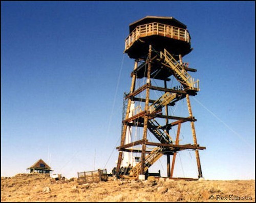
Calamity Butte has been in continuous use for 65 years, and in that period has probably lived up to its name! The wooden, ground level 14’ x 14’ live-in structure is a “Supervisor Hall Special” built on a revised California design. A predecessor design of the popular L-4 model, it is one of only two such lookouts known to remain in Region 6 (Oregon & Washington). This U.S. Forest Service lookout is still in active use on the Malheur National Forest.
Map
Change Basemap
Photos
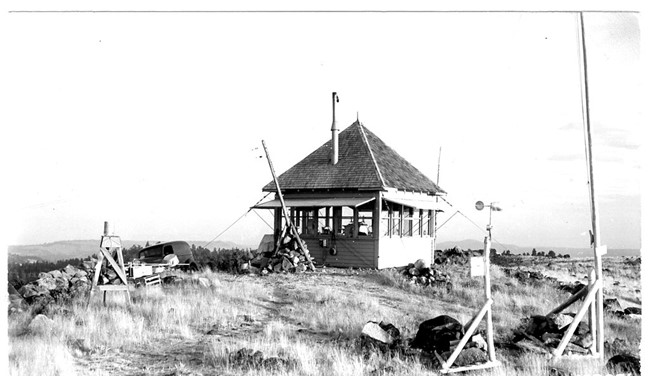
Calamity Butte Lookout - Ground cab - 1943
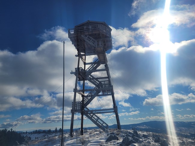
November 10, 2022 photo