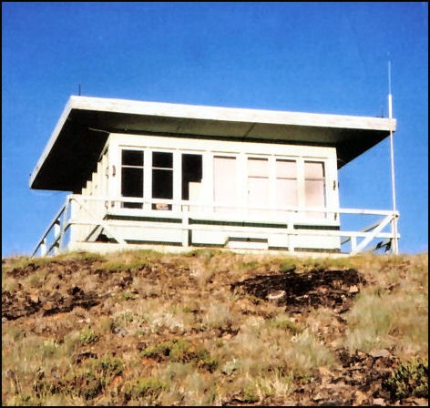
Dixie Butte Lookout
US 657, OR 108
Lookout Details
| Registry Numbers | US 657, OR 108 (view other lookouts in United States, Oregon) |
| Date Registered | March 15, 2006 |
| Nominated by | Howard Verschoor |
| Location |
Malheur National Forest Grant County, Oregon |
| Coordinates |
N 44° 34.977' W 118° 37.549' (view using Google Maps) N 44° 34' 59" W 118° 37' 33" N 44.582950° W 118.625820° |
| Elevation | 7,511 ft (2,289 m) |
| Built | 1968 |
| Administered by | U.S. Forest Service |
| Cooperators | Prairie City Ranger District |
Description
The first lookout on Dixie Butte on the Malheur National Forest was a cupola cabin in the early 1920s which was replaced with an L-4 ground house in 1935. The present 15’x15’ R-6 flattop ground house was built in 1968 and remains in active service.
Map
Change Basemap