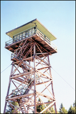
Flagtail Mountain Lookout
US 454, OR 57

Lookout Details
| Registry Numbers | US 454, OR 57 (view other lookouts in United States, Oregon) |
| Date Registered | January 8, 2003 |
| Location |
Malheur National Forest Grant County, Oregon |
| Coordinates |
N 44° 11.162' W 119° 16.842' (view using Google Maps) N 44° 11' 10" W 119° 16' 51" N 44.186030° W 119.280700° |
| Elevation | 6,569 ft (2,002 m) |
| Built | 1960 |
| Administered by | U.S. Forest Service |
| Cooperators | Blue Mountain Ranger District |
Description
The first Flagtail Mountain Lookout was a tree crows nest in the early 1920s. A 20’ pole tower with L-4 cab was built in 1933 and in 1960 the present R-6 14’x14’ flattop cab with catwalk was constructed.
Map
Change Basemap