Soda Mountain Lookout
US 340, OR 39
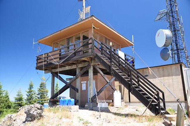
Soda Mountain Lookout - 2017
Lookout Details
| Registry Numbers | US 340, OR 39 (view other lookouts in United States, Oregon) |
| Date Registered | June 15, 2000 |
| Location |
Cascade-Siskiyou National Monument Jackson County, Oregon |
| Coordinates |
N 42° 03.869' W 122° 28.730' (view using Google Maps) N 42° 03' 52" W 122° 28' 44" N 42.064475° W 122.478827° |
| Elevation | 6,049 ft (1,844 m) |
| Administered by | Oregon Department of Forestry |
| Cooperators | Oregon Department of Forestry and Bureau of Land Management |
Description
Located on Bureau of Land Management (BLM) land on the eastern reach of the Siskiyou Range and four miles north of the California border, Soda Mountain Lookout was first a L-4 cab on 6' tower built in 1933. In 1962 the Oregon Dept. of Forestry replaced it with the present ODF 14' x 14' flat roof cab on a 10' tower. Still in active service, it is near the Pacific Crest Trail. Soda Mountain is included in the new Cascade-Siskiyou National Monument created by Presidential proclamation on June 1, 2000.
Map
Change Basemap
Photos
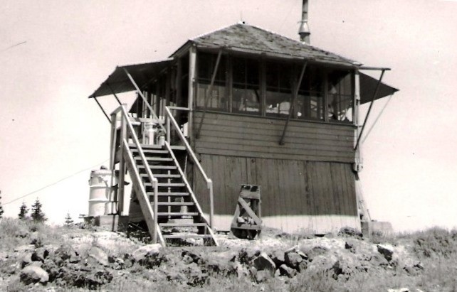
Soda Mountain Lookout - 1959