Lookout Details
| Registry Numbers | US 1771, TN 73 (view other lookouts in United States, Tennessee) |
| Date Registered | December 16, 2023 |
| Nominated by | Jason Johns |
| Location |
Franklin State Forest Marion County, Tennessee |
| Coordinates |
N 35° 04.553' W 085° 50.518' (view using Google Maps) N 35° 04' 33" W 085° 50' 31" N 35.075880° W 085.841970° |
| Elevation | 1,863 ft (568 m) |
| Built | After 1940 |
| Administered by | Tennessee Division of Forestry |
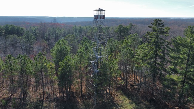
Description
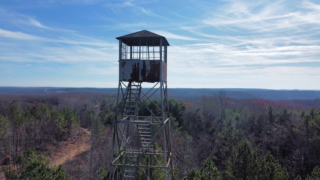
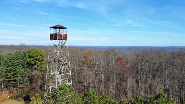
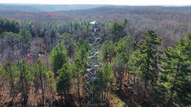
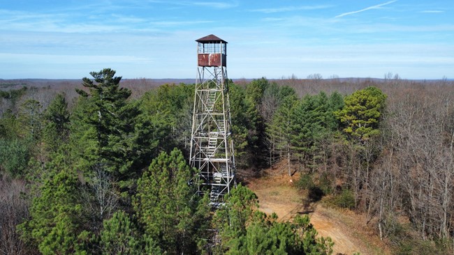
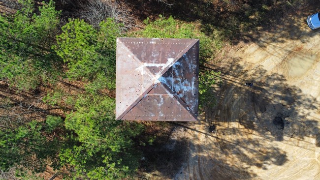
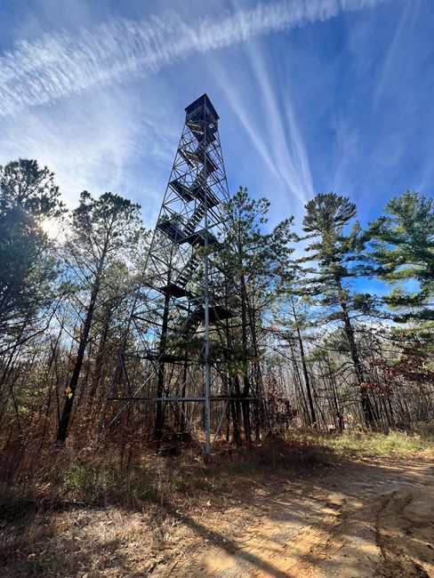
This tower is a 80ft Aermotor LS-40.
Franklin State Forest -Size: 8,836 acres/3,576 ha. The land was acquired in 1936 from the Cross Creek Coal Company and was highly degraded. Tennessee Department of Agriculture, Forestry Division assumed management of the area in 1940. The larger northern section of the forest was obtained in a land swap with The University of The South in 2008. Additional acreage was later obtained in the southwest portion of the forest through purchase from the Sherwood Mining Company. The Forest is on the Cumberland Plateau and located in south-central Tennessee, in Marion and Franklin Counties. The forest is 35-40 miles west of Chattanooga. About 99% of the land is forested and about 90% of the land is in hardwood forest types both young and mature. About 10% of the Forest is pine. The area has a history of timber abuse by diameter-limit cuts and uncontrolled wildfires. Silvicultural prescriptions are geared towards timber stand improvement, management of wildlife habitat and age class structure and diversity. It is home to a diverse number of wildlife species. The forest has been traditionally used for hunting, hiking, horse riding, off-road and ATV riding, and in designated areas camping.
Site Visit - 11/24/23
Map
Photos