Bedford Fire Tower
US 1037, VA 17
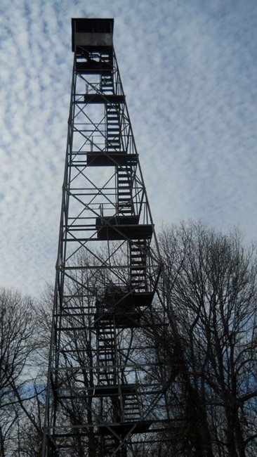
Kristin Scholetzky photo
Lookout Details
| Registry Numbers | US 1037, VA 17 (view other lookouts in United States, Virginia) |
| Date Registered | September 3, 2014 |
| Nominated by | Kristin Scholetzky |
| Location | Bedford County, Virginia |
| Coordinates |
N 37° 19.246' W 079° 31.376' (view using Google Maps) N 37° 19' 15" W 079° 31' 23" N 37.320768° W 079.522936° |
| Elevation | 1,182 ft (360 m) |
Description
Bedford Fire Tower is an 80-foot Aermotor steel tower located in Bedford County, Virginia. It serves as a prominent landmark for many miles for travelers on US Route 460 between Roanoke and Bedford.
Originally owned by the Virginia Department of Forestry, Bedford tower is now privately owned.
Originally owned by the Virginia Department of Forestry, Bedford tower is now privately owned.
Map
Change Basemap