Hayters Knob Lookout
US 1051, VA 20
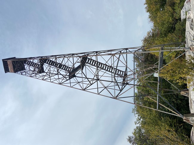
September 2020 photo
Lookout Details
| Registry Numbers | US 1051, VA 20 (view other lookouts in United States, Virginia) |
| Date Registered | December 15, 2014 |
| Nominated by | Reginald B. Childers |
| Location |
The Channels Natural Area Preserve Washington County, Virginia |
| Coordinates |
N 36° 52.280' W 081° 58.710' (view using Google Maps) N 36° 52' 17" W 081° 58' 43" N 36.871333° W 081.978500° |
| Elevation | 4,208 ft (1,283 m) |
| Built | 1939 |
| Administered by | Virginia Department of Forestry |
Description
The Department of Forestry, after being founded in 1914, started building steel towers in the 1930s. The tower was constructed in 1939 by the Civilian Conservation Corps men. The tower construction materials were carried to the construction site on mules and the men's backs. The tower was in use from 1939 until the spring of 1970. The tower commands a view of over 60 miles on a clear winter day and fewer than six feet when the fog settles over the mountain.
The lookout tower is located in The Channels Natural Area Preserve which was created in 2008 by the Commonwealth of Virginia to protect a unique sandstone formation located approximately 100 feet east. A common access route is just over a three mile hike from a parking lot on VA Route 80 at Hayters Gap on a dirt private road (easement obtained for hikers only), then forest roads.
The lookout tower is located in The Channels Natural Area Preserve which was created in 2008 by the Commonwealth of Virginia to protect a unique sandstone formation located approximately 100 feet east. A common access route is just over a three mile hike from a parking lot on VA Route 80 at Hayters Gap on a dirt private road (easement obtained for hikers only), then forest roads.
Map
Change Basemap
Photos
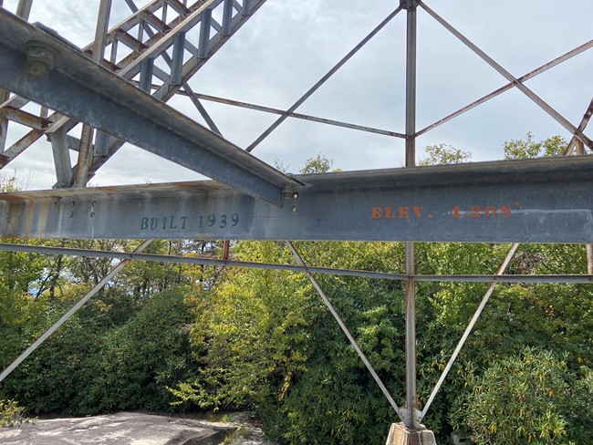
Photo courtesy of John Blackburn