Meadows Fire Tower
US 1489, VA 43
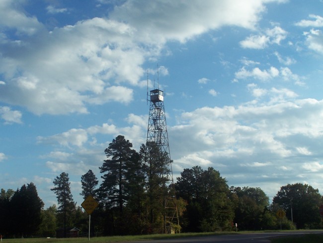
Photo courtesy of Julian Charity
Lookout Details
| Registry Numbers | US 1489, VA 43 (view other lookouts in United States, Virginia) |
| Date Registered | January 8, 2021 |
| Nominated by | Julian Charity |
| Location | Henrico County, Virginia |
| Coordinates |
N 37° 30.636' W 077° 14.327' (view using Google Maps) N 37° 30' 38" W 077° 14' 20" N 37.510601° W 077.238788° |
| Elevation | 158 ft (48 m) |
| Administered by | Virginia Department of Forestry |
Description
This tower is about 110-feet high and is located just off US 60.
Map
Change Basemap