Lorena Butte Lookout
Lookout Details
| Registry Numbers | US 1549, WA 79 (view other lookouts in United States, Washington) |
| Date Registered | April 12, 2022 |
| Nominated by | Christine Estrada |
| Location |
Private Land Klickitat County, Washington |
| Coordinates |
N 45° 47.984' W 120° 47.891' (view using Google Maps) N 45° 47' 59" W 120° 47' 53" N 45.799734° W 120.798182° |
| Elevation | 2,180 ft (664 m) |
| Built | 1974 Relocated 2006 |
| Administered by | Washington Department of Natural Resources |
| Cooperators | Private Land Owner |
| Available for Rental | Yes, learn more |
Description
The first known structure on Lorena Butte was an L-4 cab in 1937. In 1953, the owner of Lorena Butte, Irving Bath, leased his land to Washington DNR and the following year, in 1954 a DNR cab was built atop an 8′ rock formation. The site replaced nearby Simcoe Butte.
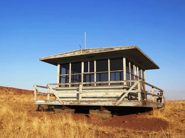
In 1974, the current DNR live-in cab was built atop a 10′ concrete slab and last staffed in 1993. In 2006, the cab was moved from the summit southwest down the ridge due to local mining operations. The concrete slab base built in 1974 remained. The lookout has occasionally been staffed in the new location during high fire danger times, most notably in July 2013 when a lightning storm swept across the area.
Lorena is now available for nightly rentals through the private land owners, Lefever Holbrook Ranch.
Map
Photos
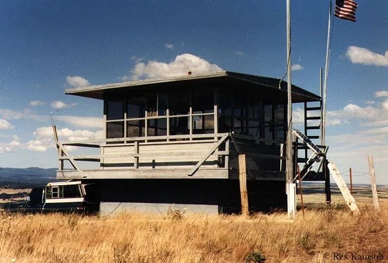
Lorena Butte Lookout - Original location - Relocated 2005