Iron River Lookout
US 1270, WI 51
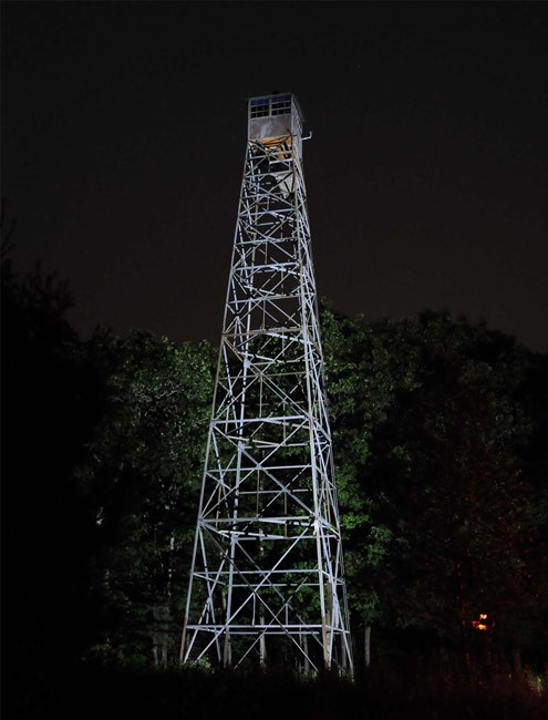
Photo courtesy of Brian Ziegler
Lookout Details
| Registry Numbers | US 1270, WI 51 (view other lookouts in United States, Wisconsin) |
| Date Registered | April 3, 2018 |
| Nominated by | Tyler Bormann |
| Location |
Chequamegon-Nicolet National Forest Bayfield County, Wisconsin |
| Coordinates |
N 46° 34.601' W 091° 19.469' (view using Google Maps) N 46° 34' 36" W 091° 19' 28" N 46.576675° W 091.324481° |
| Elevation | 1,295 ft (395 m) |
| Built | 1934 |
| Administered by | Wisconsin Department of Natural Resources |
| Cooperators | U.S. Forest Service |
Description
The Iron River Tower serves as evidence of the cooperative effort by the Forest Service and the Wisconsin Conservation Commission to conserve and protect the State’s forest resources in the early 30’s. Built in February of 1934 by the Conservation Commission on National Forest system lands, the State operated the lookout for 81 years until 2015 when the DNR decommissioned its lookout network. The 79’ 6” tall tower was manufactured by the International Stacey company and features an internal corner leg ladder.
Map
Change Basemap