Inskip Hill Lookout
Lookout Details
| Registry Numbers | US 1361, CA 184 (view other lookouts in United States, California) |
| Date Registered | October 28, 2019 |
| Nominated by | Brad Eells |
| Location | Tehama County, California |
| Coordinates |
N 40° 20.495' W 121° 56.598' (view using Google Maps) N 40° 20' 30" W 121° 56' 36" N 40.341578° W 121.943293° |
| Elevation | 3,100 ft (945 m) |
| Built | 1934/1974 |
| Administered by | California Department of Forestry and Fire Protection - Tehama-Glenn Unit (Cal Fire TGU)) |
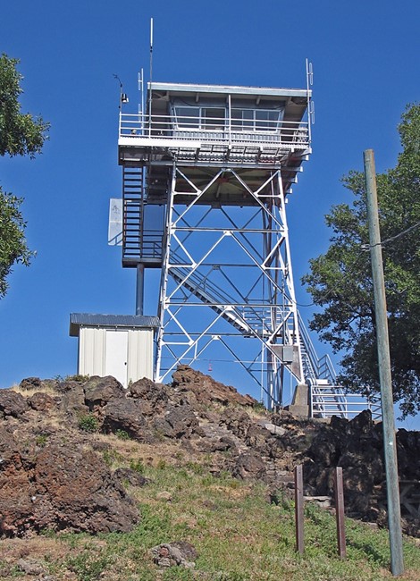
Description
The original (1934) CCC era lookout was built for the Forest Service. The tower and immediate property were quit claimed to CDF in 1971. In 1972 the stairway was replaced. In 1974 existing BC-3 cab was replaced by a 732-6A style cab. Plan 758-lA shows the remodel. The CCC era Forest Service "J" design garage has been resided with non-original type material but is otherwise intact.
The Lassen National Forest operated this site until 1958. The tower is a USFS (Plan No. L-801) design. This lookout station's tower and garage were built by the CCCs. The original cab (USFS Plan No. BC-301) was destroyed by fire. CDF constructed a new cab based on the standard 732-6A design (the remodel is CDF Plan No. 758-lA). The original stairway, catwalk and railing have also been replaced. Although the current lookout cab doesn't reflect the original design, this is an attractive cab-tower combination. The garage is a CCC era, USFS "J" design. A 1, ooo gallon water storage tank, pumping system, and bathroom facilities are located within. It has been recovered in vinyl siding and aluminum ribbed roofing. A concrete lined, root cellar alcove (20 sq. ft.) is carved into the mountain peak below the tower. It features 3" thick lumber for the door and small ice box located within.
Inskip Hill is a twin-peaked, cinder cone located in the foothills west of Lassen Volcanic National Park. Brush, oak, cedar and ponderosa pine predominate the area. There is a small repeater shed near the tower, and a little vault and antenna tower by the garage. The station is accessible to the public, being 4.5 miles from the nearest paved road. (MVT 10/91)
Map
Photos
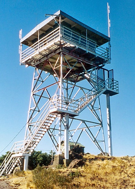
Photo courtesy of www.peakbagging.com