Pattymocus Butte Lookout - 2016
Lookout Details
| Registry Numbers | US 1362, CA 185 (view other lookouts in United States, California) |
| Date Registered | October 28, 2019 |
| Nominated by | Brad Eells |
| Location | Tehama County, California |
| Coordinates |
N 40° 17.778' W 122° 52.098' (view using Google Maps) N 40° 17' 47" W 122° 52' 06" N 40.296303° W 122.868303° |
| Elevation | 3,975 ft (1,212 m) |
| Built | 1970 |
| Administered by | California Department of Forestry and Fire Protection - Tehama-Glenn Unit (Cal Fire TGU) |
Description
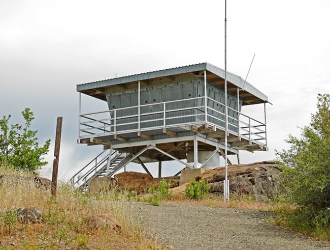
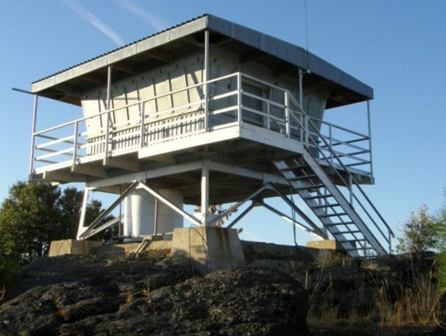
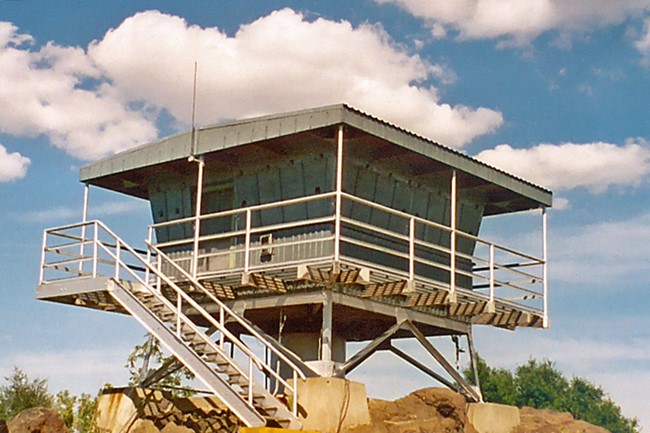
Pattymocus Butte began as an active fire detection site by 1921. Originally a cooperative site between the Forest Service and the State, CDF assumed sole operation of the lookout out in 1950. The ECW structure was replaced by existing building in 1970. It is based on CDF Plan Number 350. The cab is an early version of the standard 732-6A cab used extensively by CDF in Region 2 today. This is the shortest steel K-brace tower in the State of California.
The earlier CCC lookout and garage were replaced in 1970 by the existing facilities. The tower is the shortest K-brace tower in California. The cab is a standard CDF cab design later codified as Plan No. 732-6A. Neither structure has been modified since construction. As for the utility shed, the garage doors were removed a few years ago and plywood paneling added, with a single metal door off-set to the right end of the wall. The building is being converted for radio storage and bathroom facilities. Solar panels are also being added.
Pattymocus Butte is a low, rocky peak on the east side of a ridge complex that includes Beegum Peak to the north and Tedoc Peak to the south. (The station was initially called Beegum Lookout.) The ridge drops off rather sharply, on the east side of the Pattymocus Lookout Station, into the Kelsey Gulch and Dry Gulch areas (tributaries of Dry Creek). The area is covered in pine, oak and brush with large grassy areas interspersed. This is open range, cattle country. The site is some 7 miles from the nearest paved road. (MVT 10/91)
Map
Photos
2009
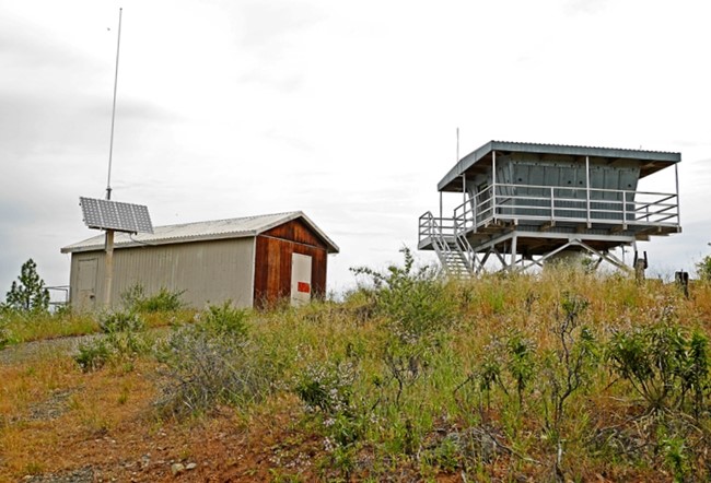
Photo courtesy of www.peakbagging.com
2004