Pike County Peak Lookout - 2009
Lookout Details
| Registry Numbers | US 1374, CA 197 (view other lookouts in United States, California) |
| Date Registered | October 30, 2019 |
| Nominated by | Brad Eells |
| Location |
Plumas National Forest Yuba County, California |
| Coordinates |
N 39° 28.490' W 121° 12.140' (view using Google Maps) N 39° 28' 29" W 121° 12' 08" N 39.474833° W 121.202327° |
| Elevation | 3,443 ft (1,049 m) |
| Built | Relocated 1983 |
| Administered by | US Forest Service - Plumas National Forest |
Description
Pike County Peak was originally part of the Tahoe National Forest.
Desiring to locate a lookout station at Pike's Peak and no funds being available for the erection of a tower, the Forest Service officials decided to utilize an immense pine which stands on the crest and overtops all surrounding timber. Nearly 80 feet from the ground the branches were thinned out and a stout circular platform built entirely around the trunk, it having a width of about 8 feet. A perpendicular ladder built against the tree extends from the ground to the platform. (Morning Union 1913)
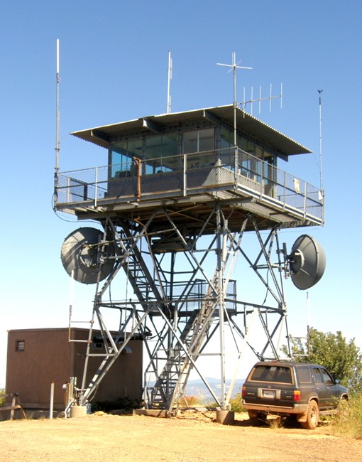
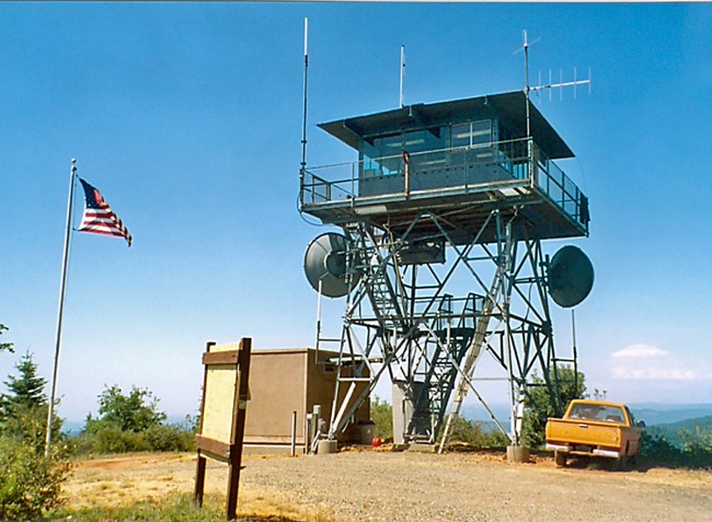
A permanent structure was completed by 1923. The current structure, a National Plan CL-100 design with a 13x13 cabin and 20 foot steel tower was located on Lexington Hill. The structure was dismantled and re-erected on Pike County Peak in 1983.
Pike County Peak Lookout was actively detecting fires in 2019.
Map
Photos
2006
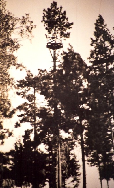
Circa 1913