June 2017 photo
Lookout Details
| Registry Numbers | US 1220, CA 123 (view other lookouts in United States, California) |
| Date Registered | June 28, 2017 |
| Nominated by | Brad Eells |
| Location | Los Angeles County, California |
| Coordinates |
N 34° 11.249' W 118° 12.479' (view using Google Maps) N 34° 11' 15" W 118° 12' 29" N 34.187483° W 118.207983° |
| Elevation | 1,893 ft (577 m) |
| Built | 1934 |
| Administered by | City of La Canada Flintridge |
Description
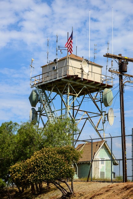
San Rafael Lookout, now known as Cerro Negro Lookout, was constructed for the Los Angeles County Fire Department in 1934. The county operated the lookout for 26 years before turning it over to the Glendale City Fire Department for use a communications site in 1960. The lookout is now managed by the City of La Canada Flintridge.
The lookout appears to be a standard L-4 14'x14' cab on a 30 foot steel K-brace tower. The cab has been modified with exterior paneling covering the walls and windows. Modern asphalt roofing material has replace the wood shakes. The site also features a Chrysler Victory Air Raid Siren mounted on a short steel tower. The lookout is located in Cherry Canyon Park and may be accessed by a number of trails. The site is a working communications facility, is fenced and is not open to the public.
Map
Photos
May 25, 1934