Phillipston Fire Tower
US 621, MA 32
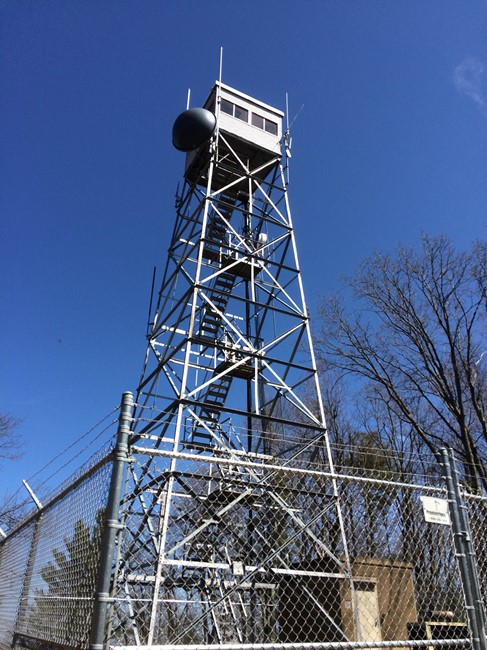
April 2016 photo by Jack Kelley
Lookout Details
| Registry Numbers | US 621, MA 32 (view other lookouts in United States, Massachusetts) |
| Date Registered | December 15, 2004 |
| Nominated by | Henry Isenberg |
| Location |
Town of Phillipston Worcester County, Massachusetts |
| Coordinates |
N 42° 32.666' W 072° 10.316' (view using Google Maps) N 42° 32' 40" W 072° 10' 19" N 42.544440° W 072.171940° |
| Elevation | 1,348 ft (411 m) |
| Built | 1939 |
| Administered by | Mass. Bureau of Forest Fire Control |
| Cooperators | Mass. Bureau of Forest Fire Control, District 8 |
Description
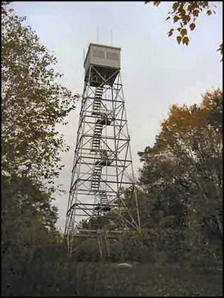
The first Phillipston Fire Tower was a 68’ iron tower opened in 1928 on land owned by the Harvard University forestry program. It too fell a casualty of the 1938 hurricane. A temporary wood tower was erected while the present 68’ steel tower with 10x’10’ wooden cab was constructed in 1939. The current tower is featured in the famed forest dioramas at Harvard University's Fischer Museum.
Map
Change Basemap
Photos
Visit Reports
April 24, 2016: Jack Kelley
Condition |
|
| Needs paint? | Yes |
| Shutters OK? | Yes |
| Condition of wood OK? | No Response |
| Stairs OK? | Yes |
| Glass intact? | Yes |
| Good condition? | No Response |
| Comments: | The tower seems to be completely automated, as on red flag days it is not staffed but has a lot of monitoring equipment on it. The paint is chipped in many places and the wood looks as if it is feeling the full effects of nature. |
Electronics and Enroachments |
|
| Are electronic sites enroaching on tower? | Yes |
| Other enroachments? | There is a lot of equipment on and around the tower, possibly meaning it is automated. There is a locked chainlink fence surrounding the tower. |
Access and Signs |
|
| NHLR sign posted? | No |
| Directions to tower signed? | Yes |
| Comments? | The tower's location is listed on trail maps for the Harvard forest. |
Staffing |
|
| Staffed? | No |
Opportunities for Volunteer Support |
|
| Volunteers staffing opportunities? | No Response |
| Volunteer maintenance opportunities? | No Response |