Sharon Fire Tower
US 560, MA 10
Lookout Details
| Registry Numbers | US 560, MA 10 (view other lookouts in United States, Massachusetts) |
| Date Registered | February 2, 2004 |
| Nominated by | Henry Isenberg |
| Location | Norfolk County, Massachusetts |
| Coordinates |
N 42° 07.433' W 071° 12.866' (view using Google Maps) N 42° 07' 26" W 071° 12' 52" N 42.123890° W 071.214440° |
| Elevation | 145 ft (44 m) |
| Built | 1966 |
| Administered by | Mass. Bureau of Forest Fire Control |
| Cooperators | Mass. Bureau of Forest Fire Control, District 4 |
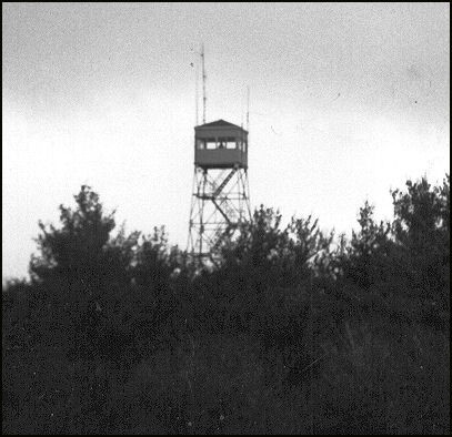
Description
Built in 1966, Sharon Lookout is a 10’x10’ cab on top of a 75’ steel tower on Moose Hill. It replaced an earlier tower erected in 1917, which in turn was a replacement for a 1912 tower on Bluff Head one-half mile south. It will be listed on the National Lookout Register until it is 50 years old.
Map
Change Basemap