West Myrtle Butte Lookout
US 428, OR 53
Lookout Details
| Registry Numbers | US 428, OR 53 (view other lookouts in United States, Oregon) |
| Date Registered | July 16, 2002 |
| Nominated by | Howard Verschoor, Oregon Registrar |
| Location |
Malheur National Forest Grant County, Oregon |
| Coordinates |
N 43° 58.476' W 119° 09.546' (view using Google Maps) N 43° 58' 29" W 119° 09' 33" N 43.974600° W 119.159100° |
| Elevation | 6,320 ft (1,926 m) |
| Built | 1928 |
| Administered by | U.S. Forest Service |
| Cooperators | Emigrant Peak Ranger District |
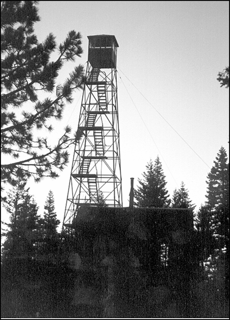
Description
When West Myrtle Butte Lookout was downgraded to emergency use status, the Malheur National Forest placed the ground living quarters on the cabin rental system to provide income for upkeep of the tower. The 67' steel structure with 7' x 7' metal cab dates back to 1928.
Map
Change Basemap