Sugarloaf Mountain Lookout
US 427, OR 52
Lookout Details
| Registry Numbers | US 427, OR 52 (view other lookouts in United States, Oregon) |
| Date Registered | July 16, 2002 |
| Nominated by | Howard Verschoor, Oregon Registrar |
| Location |
Malheur National Forest Harney County, Oregon |
| Coordinates |
N 43° 54.948' W 119° 14.292' (view using Google Maps) N 43° 54' 57" W 119° 14' 18" N 43.915800° W 119.238200° |
| Elevation | 6,002 ft (1,829 m) |
| Built | 1949 |
| Administered by | U.S. Forest Service |
| Cooperators | Emigrant Peak Ranger District |
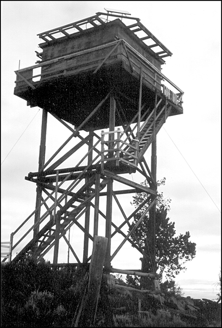
Description
The first lookout on Sugarloaf Mountain was a 15' L-4 constructed in 1932. It was replaced in 1949 with the current L-4 with catwalk on a 32' wooden tower. The Malheur National Forest site is in active service.
Map
Change Basemap