Dry Mountain Lookout
US 426, OR 51
Lookout Details
| Registry Numbers | US 426, OR 51 (view other lookouts in United States, Oregon) |
| Date Registered | July 16, 2002 |
| Nominated by | Howard Verschoor, Oregon Registrar |
| Location |
Ochoco National Forest Crook County, Oregon |
| Coordinates |
N 43° 40.320' W 119° 33.756' (view using Google Maps) N 43° 40' 19" W 119° 33' 45" N 43.672000° W 119.562600° |
| Elevation | 6,241 ft (1,902 m) |
| Built | 1932 |
| Administered by | U.S. Forest Service |
| Cooperators | Paulina Ranger District |
Description
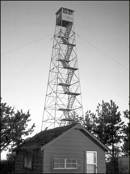
With the name Dry Mountain there is little wonder that the lookout is still staffed. The 70' Aermotor tower with 7' x 7' metal cab was constructed in 1932. The southernmost lookout on the Ochoco National Forest overlooks National Forest and BLM land.
To the north is Snow Mountain Lookout. Together Dry Mountain and Snow Mountain provided fire surveillance over the lower Ochaco sections (Burns Unit). To the south you can see clear to the Nevada-Oregon border. Northern flowing weather is easily seen from this vantage (up to 100 miles to the south). Lookouts stationed here can provide early warning when cumulus buildup is forming to the south. Dry Mountain is the first location northern-flowing dry air meets mountains and forest. The dry air is created by Oregon's and Nevada's high desert to the south. Moisture build-up then travels to the north, which is the typical summer flow for this region. Dry Mountain is an ideal location to observe lightening storms and would be considered a high fire activity location from August through October.
In 2000 and subsequent years that lookout has been staffed in extreme weather by BLM.
Map
Change Basemap