Black Elk (Harney Peak) Lookout
Lookout Details
| Registry Numbers | US 18, SD 2 (view other lookouts in United States, South Dakota) |
| Date Registered | June 13, 1991 |
| Nominated by | Frank J. Cross, District Ranger, USFS, Black Hills National Forest, Custer Ranger District |
| Location |
Black Hills National Forest Pennington County, South Dakota |
| Coordinates |
N 43° 51.941' W 103° 31.854' (view using Google Maps) N 43° 51' 56" W 103° 31' 51" N 43.865680° W 103.530893° |
| Elevation | 7,102 ft (2,165 m) |
| Administered by | U.S. Forest Service |
| Cooperators | Custer Ranger District |
Description
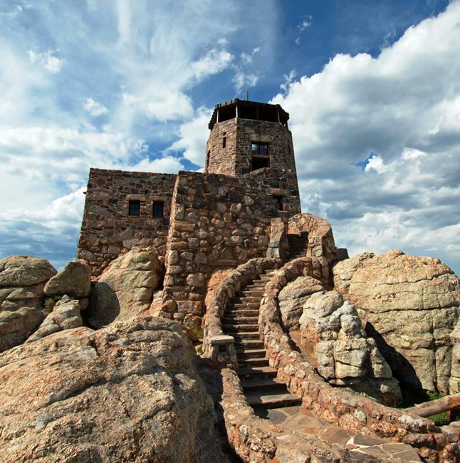
Black Elk Peak Lookout, formerly known as Harney Peak Lookout, is the highest point in the Black Hills (and the highest point that far east of the Rocky Mountains). The rock structure is unique in that it was designed by an architect especially for the site.
It was constructed by the CCC over a three-year period and was completed in 1938. Now located within a Wilderness Area, Black Elk Peak is visited by nearly 40,000 people each year.
The lookout was last used for fire detection in 1967, the structure and its history are being maintained by the Custer Ranger District of the Black Hills National Forest.
Formerly known as Harney Peak, the site was renamed Black Elk Peak by the U.S. Board on Geographic Names in 2016.
Map
Photos
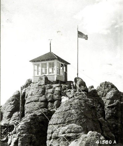
Black Elk (Harney Peak) Lookout - 1919
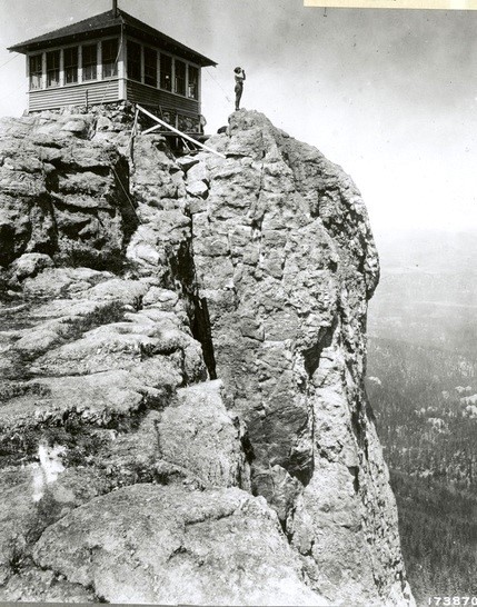
1922
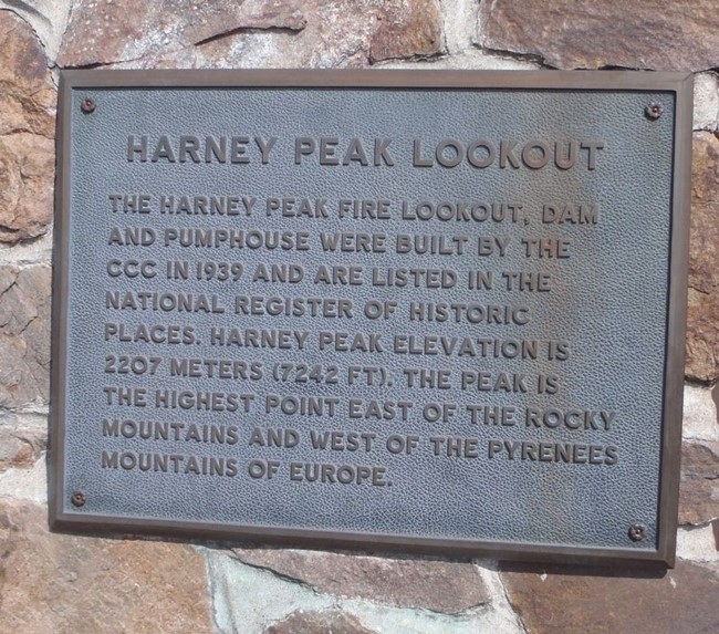
Historical Marker - 2018