Lake Tomahawk Lookout
US 1245, WI 40
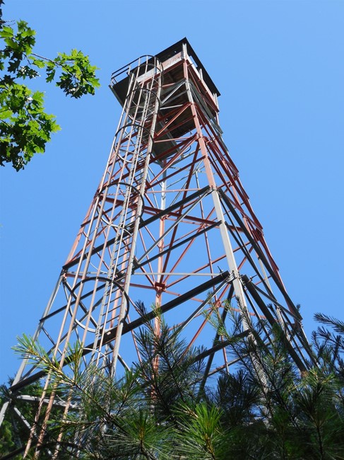
Photo courtesy of Tyler Bormann
Lookout Details
| Registry Numbers | US 1245, WI 40 (view other lookouts in United States, Wisconsin) |
| Date Registered | August 28, 2017 |
| Nominated by | Tyler Bormann |
| Location | Oneida County, Wisconsin |
| Coordinates |
N 45° 50.138' W 089° 36.618' (view using Google Maps) N 45° 50' 08" W 089° 36' 37" N 45.835639° W 089.610294° |
| Elevation | 1,735 ft (529 m) |
| Built | September 1939 |
| Administered by | Wisconsin Department of Natural Resources |
Description
This 100-foot Wisconsin standard tower features an external protected ladder and was built in September, 1939. The Lake Tomahawk Lookout was never retrofitted with the cable fall-arrest system found on other DNR ladder towers and clearly hasn’t seen active service in decades. From the ground a large hole in the roof is visible along with one missing floorboard in the cab. Alternating segments of the tower frame and cab are painted orange, likely to identify it as an aerial hazard due to its close proximity (1/2 mile) to a private airfield. Historical records indicate this tower was originally called Tomahawk Lake Lookout.
Map
Change Basemap